Tuesday, April 17, 2012

On toward the Chesapeake Bay Region

If we have not stated it before, there is a lot of secluded and undeveloped parts of this country.  As we finished our trip in North Carolina the last but certainly not the least was the Dismal Swamp Canal.  This river is part river and part man made canal.  The fascinating part of this was that George Washington had surveyed this area and thought it would be an good place for a canal to move goods back and forth between the states and to make it easier to ship tobacco and cotton to England and Europe.  So almost 300 years ago the canal was dug by slaves that were taken off the fields by their slave masters and put to work on the canal.  The slave masters were paid to have the slaves work, but the slaves never received any money.  The work was hard and grueling through a bug invested, snake invested, brown water swamp.  It sounds like a terrible job.  But as you can see from our pictures, it is a beautiful and scenic waterway today.  


Interesting as the canal is marked with the mile markers which is a very good thing as there are no red and green markers for us to know where we are.


There are two locks and two bridges on the canal.  The bridge tender is also the lockmaster and controls both of them.  Here is a picture of a turtle on a log which we took while waiting for one of the locks.


There is a welcome center at the Dismal Swamp also.  Here is the welcome flag.


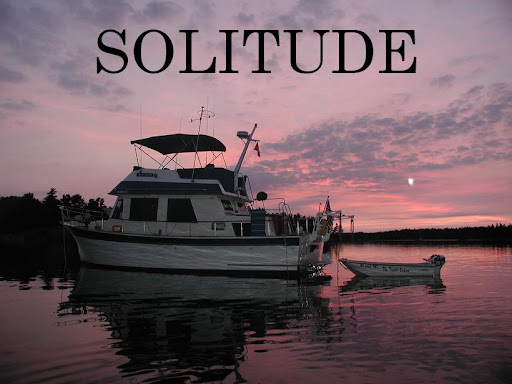
There is a dock that you can tie up to for the night and a it is also a rest area for travelers on the highway which runs parallel with the canal.  It was a unique experience for us with the boat tied up next to a highway rest stop.


We took a short hike over this bridge (which goes to the other side of the canal)  It is closed on the canal during the day for the foot traffic and folks on bicycles.  They open it for boats coming through.  Here is a picture of the bridge open and closed.  It is run by the State Park.


This is the nature center at the State Park that we visited.  It was great.


The second lock and bridge that we went through was an event.  First we had to wait while the lockmaster got the valve working that was stuck on the chamber.  (It fills the lock with water)  Then after we were let down to the height of the river, the gates on the lock groaned and creaked and would not open.  The lockmaster went over with a hammer and started to pound on the machinery to get it to release!  It was quite an event.  After a little while he did get one of the gates to open and we left with one open and one closed, good thing we are not very wide on the beam of the boat.  This is a picture of our buddies, Heidi and Ken as their boat left the lock with one gate closed
.


The next state that we crossed into was Virginia.  We traveled to Norfolk to a busy harbor with lots of ships and navy vessels.  We anchored across from the Nauticus Center at Hospital Point.  We took the dinghy across the busy shipping channel on a very chilly morning.  We toured the Nauticus Center which is packed with history of the area.  We also enjoyed a guided tour of the warship S.S. Wisconsin.  It was the size of a small city.  During the height of the ship in operation there were over 2,900 men that were assigned to the ship!  Can you imagine?  They had their own barber shop, laundry, bank, snack store, 200 cooks, and it was quite an eye opener just to see how vast the interior and exterior were.  Here is a picture of the boat at the dock.  Let me tell you when we pulled up with the dinghy I felt about as big as a speck of dust.


These are some pictures of the deck and the guns.  These guns are 16 inch bore and the turrets that they sit on require an entire crew to operate.


This was one of the displays at the center.  

Friday, April 6, 2012

South Carolina into North Carolina

As we traveled the intracoastal waterway in South Carolina there were several areas that were quite isolated and low and behold a fire tower appears and later that day we witnessed why the towers were needed.  There was a small fire across the isolated area near the waterway.  The areas and anchorages along this stretch are known for the the bugs and we had a day of fighting off the horseflies, but all in all we were very lucky as we did not have a lot of bugs.


We saw this great looking osprey on the marker board and thought we should show it to you.  They sure look a lot like an eagle.


The next town worth noting was Georgetown, South Carolina.  We did go by Charleston as it was not easy to anchor in the swift current and the marinas are expensive plus the fact it is a big city and it did not appeal to us.  In Georgetown we went into the basin area to anchor for a night as there was wind and weather heading our way.  This is Solitude at anchor in the harbor at Georgetown.


These next picture is the view from our boat at this anchorage.


This is two shrimp boats parked by the recycling crusher.

There was also a paper mill which had the same aroma as our home port of Muskegon, Michigan.

We did also go to the marina at Georgetown and caught up on our laundry and the marina staff were very helpful and gave us a ride to a Super Walmart so we were able to stock up on groceries which is always a good thing. 

We did hike around town and here are some of the sites.


This is a view of the lovely park area by the board walk.


   The scenery changed as we crossed the border into North Carolina.  Interesting that the state of North Carolina adds these friendly markers to the waterway.  They are very helpful as the waterway is measured in mile markers from Marathon (1,200) to Norfolk (mile zero).  Usually we use our waterway guides to determine where we are on the waterway along with charts, etc.


The houses in North Carolina are typically a long way from the water.  There is a lot of marsh and the tides can be as high as 4 feet so the docks are very long.  Here is a picture of the one of the middle sized docks.  That is a boat on a lift at the end of the dock and it is probably about 25 to 27 feet long)


Here is the sunrise as we see it in the morning as we leave.


Here is a picture of the rain over the ocean.  The ocean is a few miles away from the waterway that we are on and we did not have rain that day.


We began to encounter tows and barges which we had not seen since we took the rivers down to Mobile.


As you may already know, we see many bridges and this one is a called a swing bridge.  You call the bridge tender on the marine radio and he closes off the traffic and swings the bridge to let boats pass.  They typically have a schedule every hour or half hour to open the bridge to boat traffic.  This bridge is swinging toward us and in the second picture you can see a sailboat heading south and we are heading north.


We also anchored at a unique spot along the waterway called Mile Hammock.  It is right off the marine training center of Camp LaJeune.  Wow, as we traveled up the waterway, we saw this sign.


The lights were not flashing so we were able to proceed.

Although, I have to say when you can see the bombs exploding a mile or so away from you and you see the smoke, it is not the usual travel day.


Nice looking target, huh?

That afternoon and night we saw many helicopters up close and personal.  A little scary as they have the guns mounted right on the helicopter and they do fly in close as well.


Here is another one.


These were very interesting.  At night you can hear them but only see a small red dot heading past you at a fast pace.